TrailRunner 2.1v468 -- Topographic maps for Norway
10.12.09 22:00 Filed in: Maps
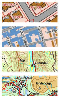
As you can see in the depicted screenshots, the quality is phenomenal.
The Map data goes from a National Map scale down to a very detailed map with properties, buildings and roads.
To view the map data, switch to the openStreetMap source and then zoom in somewhere in Norway, TrailRunner will automatically select the new source and display the background map.
> Norwegian Mapping Authority